Contents
Streatham: A 19th century dormitory suburb
by Graham Gower
Early Settlement of Streatham
For well over a thousand years, the parish of Streatham has seen the ebb and flow of human activity. Beginning with the scattered settlements of Saxon farmers and culminating in the suburban developments of the 19th century, history has endowed Streatham with a worthy past, a tapestry embroidered with an array of events and highlighted by the noble, rich and famous.
Early Streatham
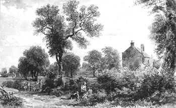
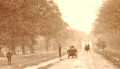
Streatham Common
1870
Five Bells c.1880
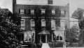
"Wood Lodge" c.1885
Mineral Wells c.1890
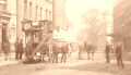
Streatham High Road
1895
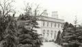
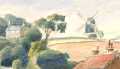
Leigham Court House
c.1895
Tooting Bec Road
c.1895
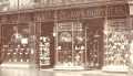
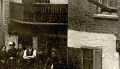
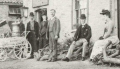
George Pratt & Co.
c.1899
However, history has not been forthcoming with the origins of Streatham, which are uncertain and clouded by the mists of time. Nevertheless, by the middle ages Streatham had become a parish which contained the villages of Streatham, South Streatham, Tooting Bec and Balham.
The origins of these villages can be found in the period of Saxon settlement that took place during the 5th century, following the demise of Roman Britain. During this period a number of Saxon family groups entered the area to farm the rich alluvial soils predominant in the lowland areas to the south and west of Streatham, and where a number of shallow river valleys marked the local topography.
Whether these groups took over existing farming estates, integrated themselves with the local population or simply settled in unoccupied areas is not known. There is, however, some evidence that suggests that people were living in the Streatham area prior to their arrival. The evidence, albeit patchy, has been the occasional finds indicating Romano-Celtic settlement activity, such as pottery, coin and building material.
Two Roman roads that were constructed through Streatham during the early decades of Roman occupation enhance the possibility of such settlement. These two thoroughfares, predecessors of the present A24 road through Balham and A23 road through Streatham, were to be instrumental in the development and growth of Streatham following the demise of Roman Britain during the 5th century.
Saxon Streatham
ĀĀ ĀThe first Saxon settlements in Streatham probably consisted of a number of scattered family groups living alongside the old Roman road. Collectively they became known as the settlement by the street, "strat-ham", thus giving us the origin of the place-name Streatham.
Similar settlement also occurred at Tooting. Here a number of farming estates were established by the River Graveney and close to the Roman Road, which later became known as Stane Street. In this area settled the followers or the people of "tota", an individual who may have been a Saxon headman or warband leader.
Further settlement also occurred to the north of Tooting in the area of the "rounded hill". Here the community became known as "Baelgenham", later as Balham, and was to become a hamlet of Streatham parish.
By the 8th century the Saxon communities at Streatham and Tooting were sufficiently established to be mentioned in a grant of land to Chertsey Abbey. The grant, attributed to the year AD 727, was further confirmed in AD 787, AD 827 and AD 933.
The Domesday Survey
ĀĀ ĀIt was not until a century or so later, with the compiling of the Domesday Survey, that we gain any appreciation of the extent of Saxon settlement.
Listed in this great document are taxable lands of Streatham, Tooting and Balham; despite their brevity, giving us a tantalizing glimpse of local life at that time.
Of particular interest is the mention of a chapel at Streatham, which was valued at 8s (40p) a year. The monks of Chertsey Abbey probably built this small structure. It was, at the time of the survey, cared for by the monks of the Benedictine Abbey of St. Mary of Bec in Normandy, France. Whether this chapel stood on the site of the present parish church of St. Leonard's is not known, but during the Norman period a church at Streatham was dedicated to St. Leonard, the patron saint of the Abbey of Bec. This church, no doubt the forerunner to the present church, was first mentioned in 1291. However, the list of rectors begins some years earlier with the mention of Robert de Rothomago, who was in office during the year 1230. No doubt by this date the church had been endowed with tithes and had been constituted as a parish church.
The ancient parish of Streatham covered a varied topography and contained approximately 2500 acres. To the north the parish boundary reached Clapham Common and Brixton Hill and to the south the River Graveney and Norbury, with a detached part of the parish laying in Lambeth parish at Knight's Hill.
The Manors of Streatham
ĀĀ ĀBy the early Middle Ages the scattered Saxon settlements had coalesced into the four villages of Streatham. Through the imposition of the feudal system, land holdings and villages were turned into well-organised manorial estates, each controlled by a Lord of the Manor through his manor court. Within the parish three manors were established which, during the Middle Ages, were held by the church.
The largest of these manors was Tooting Bec, which included the estate of Streatham and part of Balham. The manor of South Streatham was the detached part of the Lambeth manor of Vauxhall. Leigham Court manor, which covered most of the Streatham Hill area, also included the remainder of Balham and the detached portion of the parish situated at Knight's Hill.
Working under the restraints of the feudal system a majority of villagers maintained a livelihood through agriculture. Others found work in local industries such as woodland management and tile-making, whilst the general prosperity of the community was assured by its nearness to the London markets and from trade and services generated by travellers passing through the parish.
Although the population of the parish during the Middle Ages is not known, a reasonable estimate would be a few hundred or so people inhabiting the wooden-framed tenements of the four villages.
However, there is some evidence to suggest a drop in the local population following the Black Death of 1349, an event which did much to remove the shackles of feudalism and to improve the status of many Streatham tenants by the reduction of their feudal obligations.
A further indication of the well being and wealth of the parish was reflected in work done to the parish church, especially during the mid 14th century when the church appears to have been enlarged with the building of a tower, and by endowments and gifts given to the church prior to the reformation of the 16th century.
The Village of Tooting Bec
ĀĀ ĀAlthough the parish church lay within the village of Streatham, the centre of local activity was at Tooting Bec, the largest of the parish villages. Tooting Bec appears to have been a planned linear village, probably laid out by the monks of Bec following their acquisition of the estate.
Most of the tenements and cottages were concentrated along the north end of Upper Tooting Road, with Glenburnie Road marking the Back Lane to the village fields. The status of the village was enhanced by the existence of a moated manor house, attendant vineyards and archery butts, and by its favourable position alongside the busy highway of Stane Street. Northwards along the highway, and in marked contrast to Tooting Bec lay Balham, a community consisting of a few scattered farmsteads set back from the highway.
Streatham Village
ĀĀ ĀAt Streatham the tenements of the villager lay dotted along the highway, with an occasional footpath or lane leading off to the fields and to neighbouring parishes. Beginning near Becrnead Avenue with a few properties, the village continued along the highway to the parish church where a concentration of buildings would have been seen. The next cluster of buildings lay further south along the highway at Greyhound Lane and by the crossing point of the River Graveney at Green Lane.
Separating these areas of habitation would have been the open fields of the parish in which the villagers worked their strips of land. Also marking the landscape were the woodlands and stretches of lush green meadow and pasture land, separated in places by the irregular expanses of manorial wastes. Later these were to become the open spaces of Streatham Common and Tooting Bec Common.
The configuration of these villages, with their scatterings of buildings, patchwork of hedged fields, woods and meandering lanes and track ways, were to remain almost unchanged until the arrival of suburban development centuries later. To generations of villagers such things appeared to be fixed in time and space.
Before the beginnings of suburban development, the parish experienced the usual problems and changes effected by national events such as population fluctuations, pestilence, poor harvest years and civil disturbance. Of the many events that were to mark the course of Streatham's history, the Reformation of the 1530s was to be one of the most important.
Post Reformation Streatham
ĀĀ ĀFollowing the Reformation the manorial estates of Streatham, which had been held by the church, finally came into secular hands. This in turn was to stimulate changes in land tenure and use. Many of the old open fields and meadows of the parish had been, or were in the process of being, enclosed to make more efficient use of land and of new and improved farming techniques.
Across the parish new farming concerns appeared. These were invariably established through the enterprise of individuals, many who were successful merchants or courtiers benefiting from the reforms and changes brought about by the reformation. Among these individuals were the new Lords of the Manor who saw their estates as a family business, or as a source of personal revenue and status. Working through the manor courts and with the judicious use of leases, they were able to maintain and improve their investments. In a number of cases these new estates were to mature into larger agricultural units, creating what became the "old" farms of Streatham: farms named Fursden, Covey's, Grey's, Bridge House and Mount Nod. It was through these farms that the future pattern and look of suburban development in Streatham were sown.
Foremost among those families who speculatively developed their farming estates were the Howlands. Merchants by trade, this family obtained the manors of Tooting Bec and Leigham Court during the early decades of the 17th century, a move which made the family the principal landholder in the parish. Through a marriage in 1685, the estates of the Howland family passed into the hands of the Duke of Bedford whose family managed their Streatham holdings well into the following century, during which they started to sell off their local property and land interests: a policy which was to have a long term effect.