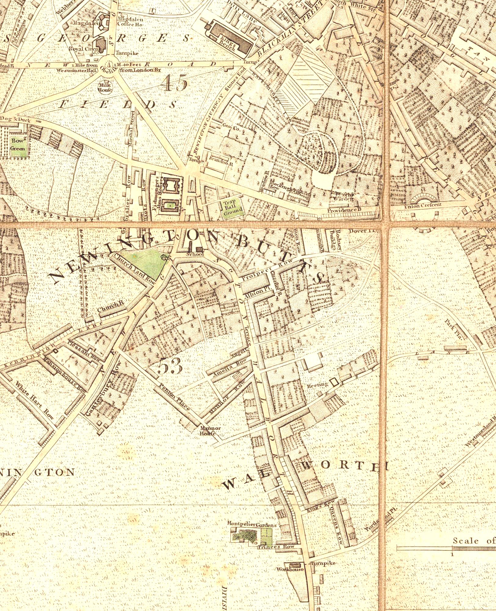
Map of Walworth, Lewisham, 1787
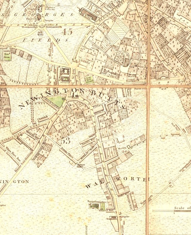
This section of the Cary map shows Walworth in the very earliest stages of its suburban development.
There is ribbon development along some of the main roads. However, what became the New Kent Road was too new to have attracted builders and is neglected, save for Michael Searle's Paragon.
The west side of Newington Causeway is untouched due to its marshy ground.
The rest of the area is market garden, pasture or marsh.
Click on the map above for an enlarged image or click here for a larger, readable image (slow download).
Extract from John Cary's New and Accurate Plan of LONDON AND WESTMINSTER, the Borough of SOUTHWARK and parts adjacent: viz. KENSINGTON, CHELSEA, ISLINGTON HACKNEY, WALWORTH , NEWINGTON, &c with an Alphabetic List of upwards of 500 of the principal Streets with references to their situation. Printed in 1787.


