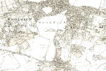
Map of Woolwich and Charlton, 1869
During the Crimean War the Royal Arsenal at Woolwich expanded enormously and the greatly increased labour force needed housing.
By 1869 there was no development land left in Woolwich apart from the Common which was owned and used by the Royal Regiment of Artillery.
Development could only take place to the east in rural Plumstead, and later, to the south in Eltham.
Both the Royal Dockyard to the west of Woolwich and the Royal Arsenal to the East are shown, for security reasons, as blanks on all maps (seen at the top of this section).
The central area and Woolwich Common are also blank for the same reason.
Not all of Woolwich was developed for housing - a large and smart shopping centre was also developed in the first half of the 19th century. Centred around Powis Street it is still one of the principal shopping areas in the Borough of Greenwich.
Click on the map for an enlarged image or click here for a larger, readable image (slower download).
Ordnance Survey, 6" to a mile, published in 1869.


