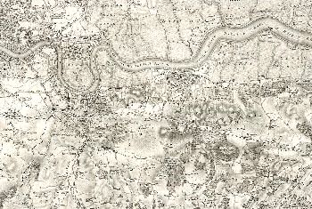
Map of Greenwich and Surrounding Areas, 1805

This sheet of the Ordnance Survey 1st Edition shows the whole of the Greenwich area prior to the surges of suburban development later in the century and in the following century.
Deptford, Greenwich, and Woolwich are already significant riverside towns but the rest of the borough is predominantly rural.
Deptford and Woolwich both have royal dockyards, and Woolwich has, in addition, the Royal Arsenal, and the Royal Artillery Regiment.
Eltham's flourishing village street astride the main road from London to Maidstone is surrounded by productive farmland all the way to the border with Chiselhurst.
Kidbrooke is a tiny hamlet surrounded by fields but the adjacent Wricklemarsh Estate, is already developing into a wealthy residential area following the demolition of the huge and grand Wricklemarsh House.
Click on the map for an enlarged image or click here for a larger, readable image (slower download).
Map drawn by Lt. Colonel William Mudge, published by the Board of Ordnance.


