Map of Peckham, Lewisham, 1891
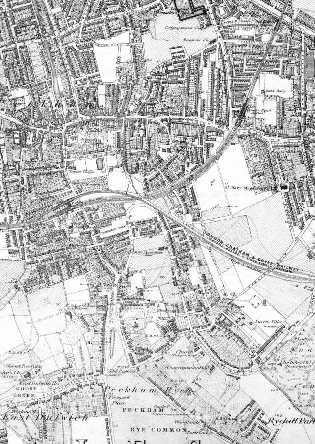
This map shows Peckham on the way to becoming a London suburb.
Railways have been built (as have tram-lines, though they are not indicated here), and most sites near main roads have been developed.
However, large tracts of remaining agricultural land are still to be developed.
Click on the map above for an enlarged image or click here for a larger, readable image (slow download).
Ordnance Survey, surveyed between 1863 and 1870, printed in 1891.


