History of East Dulwich
East Dulwich – the district bounded by Lordship Lane to the south and west, Peckham Rye and Forest Hill Road to the east and East Dulwich Road to the north – is the finest example of 19th century suburbia in Southwark.
It was a classic suburban development: built over a relatively short period of time; aimed at a particularly narrow target market; managed by a specialist development company; dependent for success on the availability of public transport; and largely intact today.
The area was transformed from fields and market gardens to housing in the period 1865 – 1885 by the development of two estates. The area between Wood Vale, Barry Road and Lordship Lane was part of Friern Manor Farm, a large dairy farm, while the area to the west and bounded by Lordship Lane, Barry Road and East Dulwich Road was part of the Bower-Smith estate. Friern Manor Farm was bought by the British Land Company, which then sold it as 200 building plots. Builders were attracted by the proximity to London, the hope that homes would be easy to let to residents attracted by being in an entirely new development, and by the availability of good transport.
Transport played an important role with the coming of railways to Herne Hill in 1862, West Dulwich and Sydenham Hill in 1863 and East Dulwich and North Dulwich in 1868. Cheaper fares beginning in the 1880s further stimulated demand and the arrival of the tram along Lordship Lane, Dog Kennel Hill and Peckham Rye in the early 20th century sealed the area’s success.
The houses were aimed at socially mobile members of the lower middle classes - typically London clerks - and the new population was largely one of young families. They largely preceded services such as shops (which developed along Lordship Lane), places of worship (such as St Clement’s, Friern Road, built in 1885), and education and leisure facilities (Dulwich Baths dates from 1892).
Although built at the same time and aimed at the same market, the houses display a remarkable sense of variety of style, from the simplicity of Nutfield Grove to the flamboyant Victorian Gothic of Barry Road.
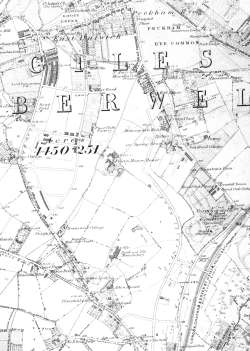
This map shows East Dulwich on the cusp of its rapid transition from country to suburb.
Friern Manor Farm House and a scattering of agricultural cottages are still there, while the framework of new roads on Bowyer-Smith estate have been laid out and terraces of houses have started to appear.
Click on the map for a larger view or click here for a readable version which may be slow to download. In the south-eastern corner is the recently built Crystal Palace High Level Railway and next to it Camberwell (old) Cemetery.
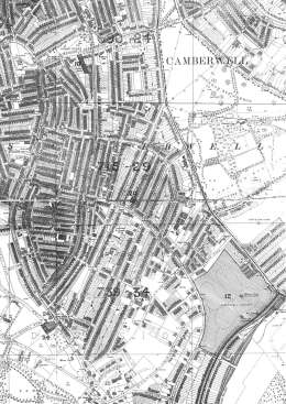
This map shows East Dulwich almost at its full Victorian extent; only a few plots in the south between Overhill and Upland Roads await development.
Peckham Rye Common and Goose Green have been preserved as public open spaces and Peckham Rye Park has recently opened to augment open spaces near the Rye.
Click on the map for a larger view or click here for a readable version which may be slow to download.
The scarcity of development in the southwest corner on the Dulwich Estate is particularly noticeable. Dulwich Park acts in part as a buffer between the body of the estate and more general suburban development to the north.
Stanford Ordnance Survey Map, 1894.


