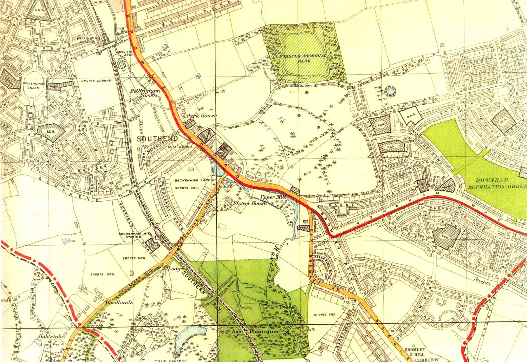
Map of Southend, Lewisham, 1930
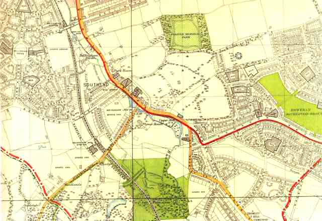
The great 1920s London County Council estates of Bellingham and Downham were hemming in Southend Village by 1930, and such farmland as remained was already being marked out for building by private developers.
The picturesque Whitefoot Lane was soon to be straightened as a dual carriageway.
Park House was destroyed by a flying bomb in 1944, and Flower House was replaced by a Lewisham Council estate in the 1940s.
Click on the map for an enlarged image or click here for a larger, readable image (slow download)


