Aerial View of Catford, Lewisham, c. 1920
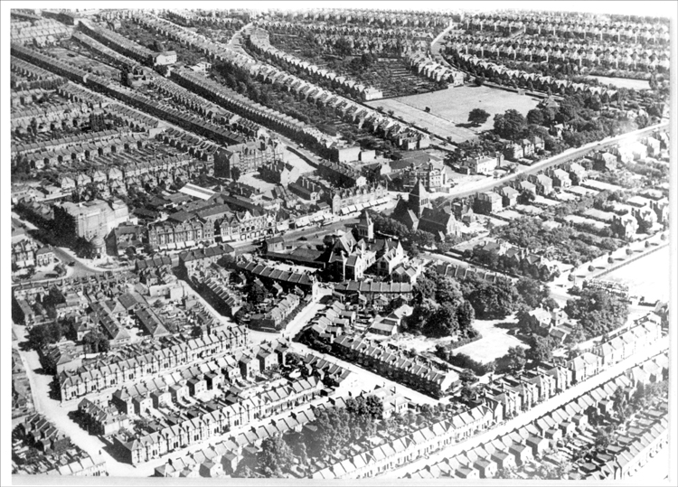
This view looks towards the south east.
Central are the twin towers of the old Town Hall of 1875 and St Laurence's Church of 1887 to its right.
The Town Hall and St Laurence's were demolished in 1968 to make way for new council buildings.
The streets in the foreground (Nelgarde, Silvermere and Brookdale) date from the 1880s. The Forster Estate in the background, hinging on the curved Penerley Road, was built between 1903 and 1914.
There are three cinemas and a theatre in the view.
In the distance the Plassy Road London School Board school, a typically substantial building, can be seen in the centre.


