Map of the Thorneycroft Estate, Stockwell, 1773
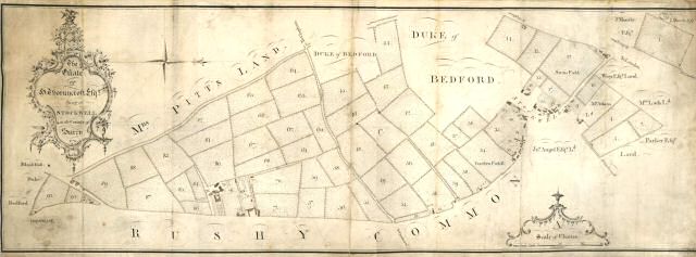
A map of the estate of Sir John Thornycroft, Lord of Stockwell Manor.
With the advent of wealthy City merchants moving into areas like Stockwell and Brixton at the end of the 18th century and the beginning of the 19th, large houses and lands were being sub divided.
This estate was split up and in 1802 and auctioned off to separate owners.
Rushy Common, seen at the bottom was the marshy area at the point where the land begins to rise towards Brixton Hill, and is still seen as a green strip east of present day Brixton Hill. New Park Road replaced Bleak Hall Road on the left, and Acre Lane is the lane in the centre of the picture.
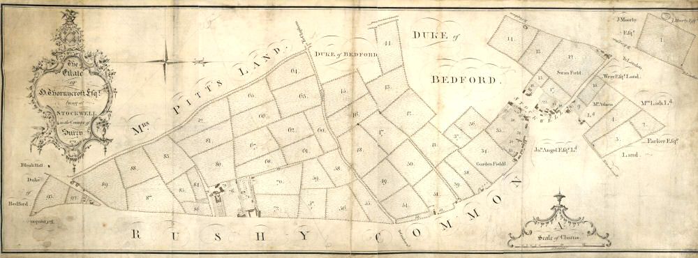
Click here for a larger version of the above map.


