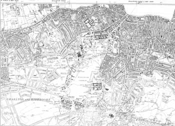
Map of Woolwich, Plumstead and Shooter's Hill, 1938

By 1938 Woolwich and Plumstead had been extensively developed for residential housing and industry.
The summit of Shooters Hill had survived development pressures but, as can be seen on this map, had finally succumbed. The Laing Estate was built in the grounds of Shrewsbury House and, on the other side of Shrewsbury Lane, development was also taking place.
However, to the east open land has survived: Shooters Hill Golf Course, and the highly attractive fields of Woodlands farm, which is now a successful community farm.
Click on the map for an enlarged image or click here for a larger, readable image (slower download).
Section from Ordnance Survey Map, 1938


