Sidcup 1897
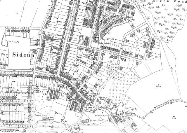
This map shows Sidcup at an early stage of its development.
Shops and dwellings have been built along the High Street, Hadlow road, Hatherly Road and Station Road, leading to the railway station at the northern end of the town.
The land around Sidcup Place, the Manor House and St John's Church forms a Town Green, while there are still woods and farm land visible to the east of St John's Road.
There is a cottage hospital and a school on Birkbeck Road.
1:2500 OS map, published by the Ordnance Survey Office, Southampton, 1897.


