Map of Blackfen, 1897
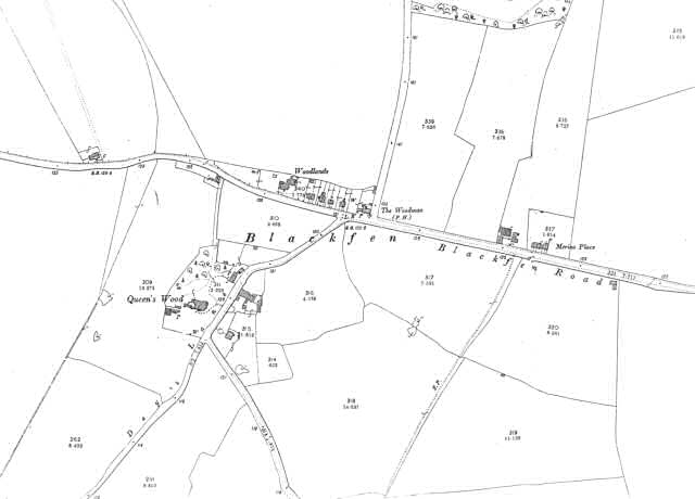
This map shows Blackfen prior to its development as a residential suburb.
The land is given over to agriculture, but there are a few large houses, such as Merino Place, Queen's Wood and Woodlands.
The Woodman Public house serves travellers on the Blackfen Road.
Up until 1870 the land north of Woodlands was a forest known as West Wood.
1:2500 OS map, published by the Ordnance Survey Office, Southampton, 1897.


