Map of Dulwich, Lewisham, 1894
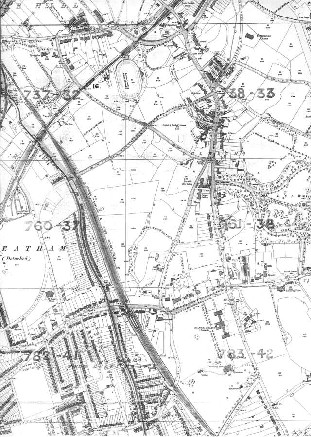
This map shows emphatically how successfully the Dulwich Estate development was during the 19th century.
The village retains its shape of a century ago but to its edges are two important changes: Dulwich Park, which opened in 1890 and the Charles Barry buildings of the Dulwich College of 1870.
To the northwest new roads have been laid out, awaiting the erection of generously proportioned terraces, semis and villas.
The Estate (and parish) boundary is shown by the dark line west of the railway on the left of the map, and over that boundary development is markedly more intense.
Click on the map above for an enlarged image or click here for a larger, readable image (slow download).
Stanford Ordnance Survey Map, 1894.


