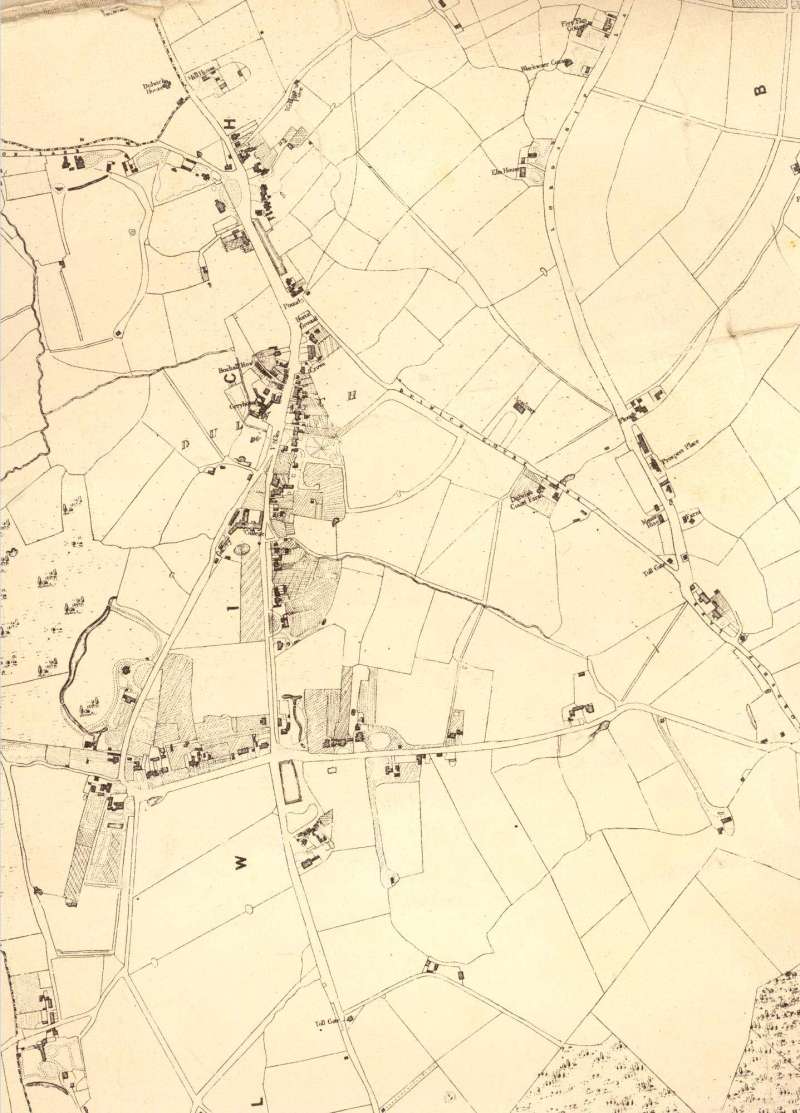
Map of Dulwich, Lewisham, 1842
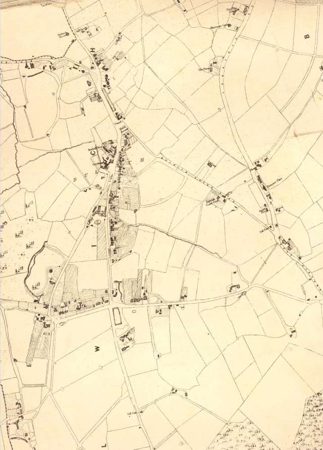
This section of the Dewhirst map of Camberwell shows the heart of the Dulwich Estate.
Lacking a parish church, the village evolved two centres depending on inclination: the College or the public house, the Greyhound.
The village was the commercial centre but on the main road south, which later became College Road, and on Dulwich Common are large detached houses.
Prominent is Belair with its extensive grounds and fishpond.
Click on the map above for an enlarged image or click here for a larger, readable image (slow download).
Map of the parish of St.Giles, Camberwell, delineating its ecclesiastical and parochial details. Drawn by J Dewhirst, surveyor, and published by W Wheeler, 1842.

Accacia Grove 1985
Alleyn Park 1984
Belair c.1972
Bessemer House Observatory c.1890
Bowen Drive, Kingswood Estate, Dulwich, c. 1985
College Road 1985
College Road c.1905
Crescent Wood Road 1986
Dovercourt Road 1985
Dulwich College c.1910
Dulwich College Chapel c.1890
Dulwich Old College 1891
Dulwich Village 1890 - 1905
Dulwich Village 1890 - 1905
Dulwich Village 1890 - 1905


