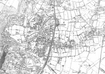
Map of Sydenham, Lewisham, c. 1865
The key dates in the suburban development of Sydenham are 1839, when the railway station opened, and 1852, when it became known that the Crystal Palace was to be rebuilt on the hill above the village.
Spurts of building followed both these events. The Crystal Palace boom was especially strong, and luxury housing was already covering much of Upper Sydenham by 1863.
Lower Sydenham was still largely agricultural.
Click on the map above for an
enlarged image or click here for a larger, readable
image (slow download).
Ordnance Survey, 1863 - 1870.


