Lewisham High Street, Lewisham, c. 1870
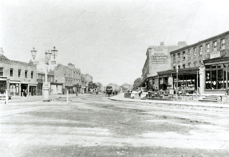
This view looks north along the High Street at its junction with Lee High Road.
The height of the High Pavement under which flowed the River Quaggy is apparent.
This part of the High Street was in the last throes of the transition from residential to commercial as there were still some private houses left just to the left of the Lion and Lamb public house. Note the recently built terrace (right) that was later dominated by Chiesman's store, and now by the police station.


