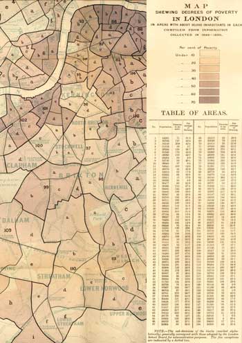
Lambeth Poverty Map (Map I), 1891
The Lambeth area from Map.1, 'London Poverty by Districts', taken from the 'Survey of Life and Labour of the People in London' by Charles Booth (1840 - 1916).
The survey of living and working conditions in London took him and his team of researchers 17 years to complete and was published in 17 volumes.
The study highlighted the growing awareness of social problems, such as overcrowding, bad sanitation, poor water quality (resulting in diseases like cholera), and flooding.
Lambeth, likened to a cesspool, inherited further problems as slums around Westminster were cleared.
Click on the map for an enlarged image or click here for a larger, readable image (slower download).
Map published with the appendix to Volume II of the Survey by Stanford's Geographical Establishment, 1891.

