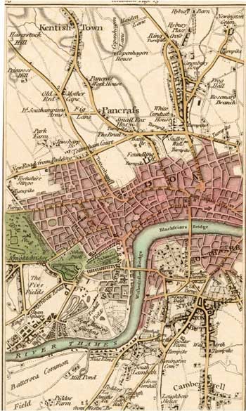
North Lambeth and Central London, 1786
Map of the northern part of Lambeth and the surrounding area from Cary's 'Actual Survey of the Country Fifteen Miles round London'.
The new road from Black-friars Bridge to St George's Circus had recently been completed, and the various turnpikes in the north of the borough are also shown.
Development north of the river is not reflected in the south except in pockets by the bridges and the riverfront, the rest maintaining a rural aspect with fields, villages and large private estates.
Click on the map for an enlarged image or click here for a larger, readable image (slower download).
Printed for J. Cary, engraver, Map & Print-seller, June 20th 1786.


