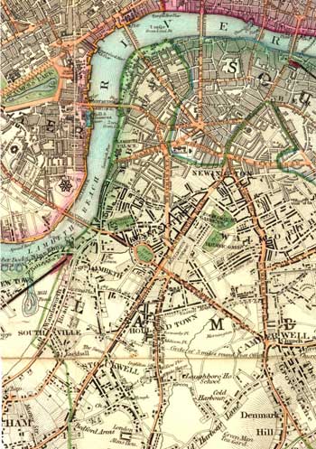
North Lambeth, 1840
This map of the northern part of Lambeth marked inns, parks and places of interest to the public.
The area adjacent to the river near the Borough High Street was the most developed with dense housing and many industries in contrast to the open land further south.
North Brixton, seen at the centre, then called Holland Town, was developed by Henry Vassall, 3rd Baron Holland of Foxley, com-memorated by 'Holland' Grove, 'Vassall' and 'Foxley' Roads.
Of note are the Zoological Gardens near Kennington Road, which were to become the temporary home of St Thomas's Hospital in 1862, before it moved to its present position in 1871.
Note also the Hungerford Pier at the northern end of Waterloo Bridge. In 1839 plans were laid to build a suspension footbridge designed by Isambard Brunel, which was completed in 1845.
Click on the map for an enlarged image or click here for a larger, readable image (slower download).
'Map of London and its Environs', published by B. R. Davies, 1840.

