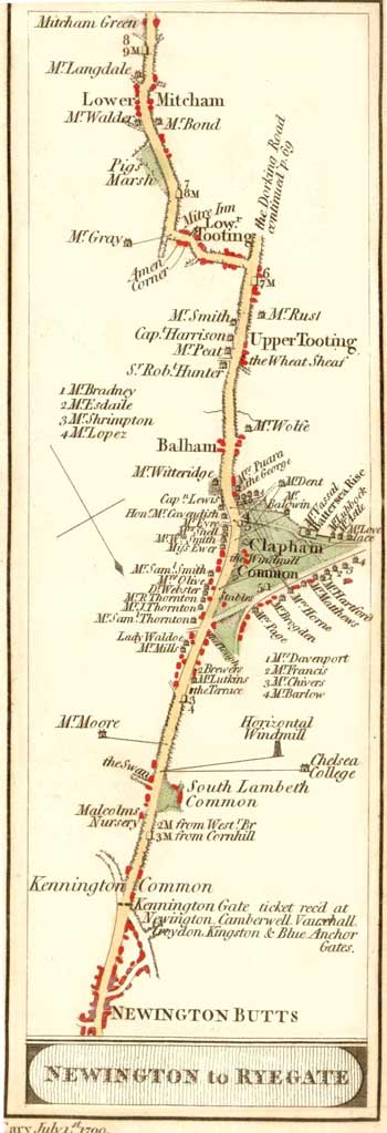
The Road from Newington towards Ryegate, 1790
A map showing the Northern part of the road from Newington to Ryegate, from Newington Butts south to Mitcham Green. This map runs from south to north.
The road, formerly Stane Street, followed the route of the old Roman road which ran from Southwark to Chichester.
Kennington Common and the tollgate are seen at the bottom of the picture.
The map, a response to the increased coach travel to and from London, lists some of the prominent inns and sites and the names of residents en route and around Clapham Common.
Ryegate is now called Reigate.
Map from 'Cary's Survey of the High Roads from London' printed for J. Cary, Engraver & Map seller, July 1st 1790.

