Proposed Layout of Manor Park Estate, Streatham, c. 1860
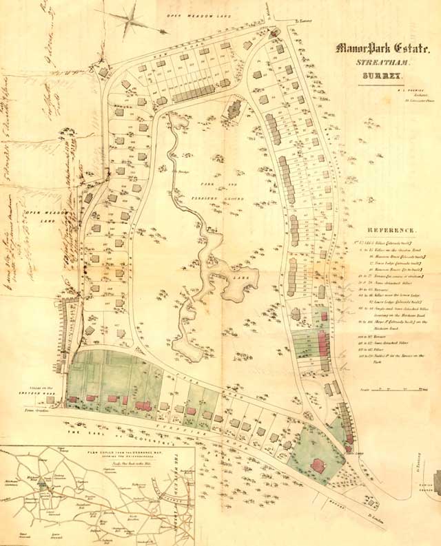
A map showing a proposal to develop housing around a park on the Manor Park Estate, consisting of more than eighty acres of ground between Streatham High Road and Mitcham Lane.
It is advertised as being well wooded and having a large ornamental fish pond, with a lake and shrubbery in the course of formation.
Attention is drawn to the fact that 'the surrounding neighbourhood is formed of houses of a superior description'.
Of interest is the house shown in Streatham Green which was then, as now, common land.
Click on the map for an enlarged image or click here for a larger, readable image (slower download).
Plan entitled 'Manor Park Estate' published by the architect, R. L. Roumieu


