Aerial View of Streatham High Road, c. 1920
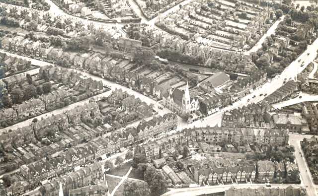
Aerial view of Streatham High Road, showing the Methodist Church in the centre, at the junction of Stanthorpe Road and Streatham High Road.
The church suffered bomb damage during World War II and was replaced by a three storey modern block of flats with a shop below and a car park at the back.
Streatham Green can be seen at the bottom left, and the old Town Hall, facing the junction of Gleneagle Road and Ambleside Avenue, on the right.


