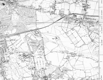
Map of Eltham, Blackfen and Welling, 1938

By 1938 the eastern side of Eltham were being developed. Even areas of ancient woodland were disappearing and survive today only as names: Colepits Wood and Rennets Wood. Without the intervention of the London County Council Oxleas Wood would also have been built over.
New roads were about to provoke further building. Rochester Way and Welling Way can be clearly seen cutting their way through open land.
Click on the map for an enlarged image or click here for a larger, readable image (slower download).
Section from Ordnance Survey Map, 1938


