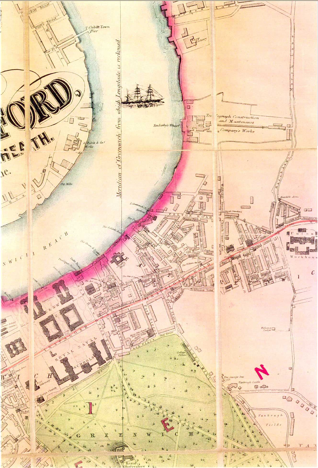
Map of East Greenwich, c.1870
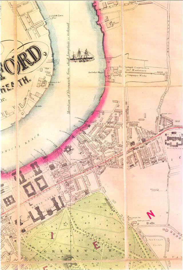
Since the 1430s the town of Greenwich has been split into two areas: West Greenwich and East Greenwich, with the royal palace and park dominating the centre.
Although East Greenwich was well developed even in the Tudor period, its rapid period of growth was in the 19th century when the riverside was developed for industry, and the adjacent fields for housing.
Bacon's map not only clearly shows the extent of Morden College's East Greenwich Estate and the names of the streets, but also the names of some of the terraces within the streets as well as the names of local public houses.
This estate, which was developed between 1842 and 1869 to the designs of George Smith, can be seen between Christ Church and the river and includes Pelton Road, and Church Street (Christchurch Way).
To the north-east of the estate is the Greenwich Peninsula with its new industrial development.
Click on the map for an enlarged image or click here for a larger, readable image (slower download).


