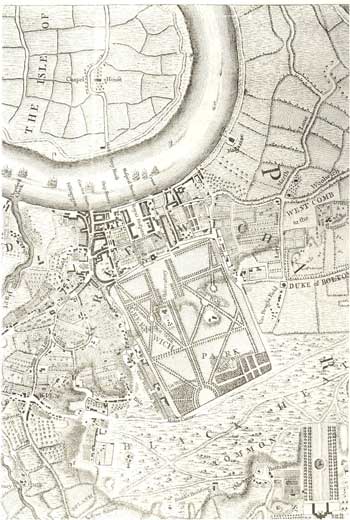
Map of Central Greenwich, 1746
This section of John Rocque's map shows the geographical dominance of the town of Greenwich, extending from the Canterbury Way (A2) on Blackheath to the river, and encompassing the royal park, the Royal Hospital for Seamen (Old Royal Naval College), and the heavily populated riverside streets of the town on either side of the Royal Hospital.
On either side of the town were marshlands, stretching to Deptford Creek on the west and the vast area tongue of land now known as Greenwich Peninsula.
Many elegant and expensive houses can be seen around Blackheath and in Crooms Hill adjoining the western side of the park.
Click on the map for an enlarged image or click here for a larger, readable image (slower download).
Printed copy (1810), of original survey made in 1695, drawn by Samuel Travers.


