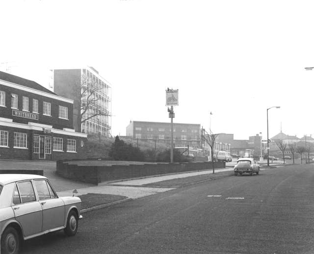
Chipperfield Road, Cray Valley, 1969
The St Paul's Cray Estate was built to be self-supporting and the Chipperfield Road area supposedly contained almost everything a Chipperfield community could want.
On the right hand side (not pictured) were the Midfield Secondary Schools and the branch library; to the left is the Partridge Pub and a petrol station. In the distance is St Barnabas' Church.
Behind the flats in the middle distance is Cotmandene Crescent containing a wide range of shops. Only the schools have failed to survive.
Photograph taken on 5th December 1969. Copyright: Topham Picture Source


