Northumberland Heath 1933
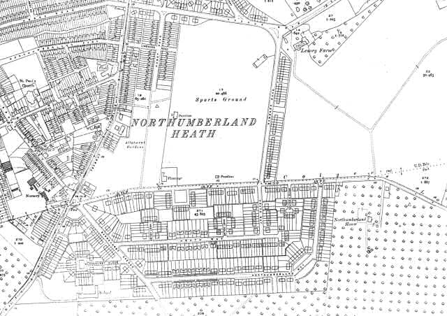
This map shows Northumberland Heath after a period of rapid sub-urbanisation.
New streets have been laid out south of Colyer's Lane.
All the land west of Lesney Farm has been given over to housing, allotments and a large sports ground.
St Paul's Church has been completed, but the old windmill has disappeared.
1:2500 OS map, published by the Ordnance Survey Office, Southampton, 1933.


