Map of Bexley Village, 1897
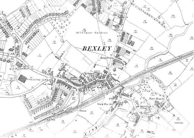
This map shows the old village of Bexley as the centre of a rural community, despite the coming of the railway in 1865.
There are shops and private dwellings crowded along the High Street from the Church of St Mary in the east to the new Church of St John in the west.
They include Styleman's Almshouses opposite the station.
Other houses can be seen on Bourne Road beyond Bexley Brewery and the National School, and also along Parkhurst Road and Knoll Road.
1:2500 OS map, published by the Ordnance Survey Office, Southampton, 1897.


